

Overview
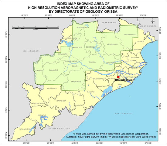
In an attempt to resort to the latest technology of exploration for minerals and groundwater Govt. of Orissa in collaboration with World Geoscience Corporation of Australia embarked upon the five year (1993-1998) High Resolution Airborne Survey Project. Directorate of Geology, Orissa has the proud privilege of possessing these data for more than 3,30,000 line kilometers covering an area of 75,000 sq. km in hard rock terrain of the state.
These data are utilized for interpretation of structure and geology of the area and are available to entrepreneurs at Government approved price.
 |
Data sets acquired during the survey:
|
|
|
N.B. : The above Aerogeophysical data has been shared with Geological Survey of India recently for proposed National Aerogeophysical Mapping Project (NAGMP) |
||