Outputs:
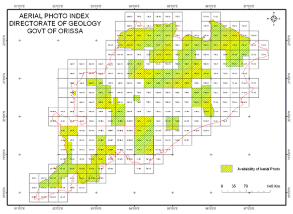
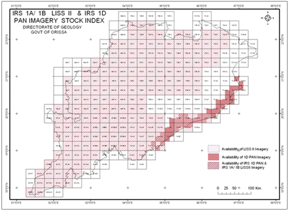
 Remote sensing technique, because of its synoptic view, high resolution and repetitive coverage has an edge over other traditional methods of survey. This is economic in terms of time and money and has been accepted as one of the best aids in geological mapping and exploration. As most of the mineral deposits and groundwater occurrences are either structurally or lithologically controlled, lithostructural maps prepared from satellite data immensely help a geologist in targeting mineral/ groundwater occurrences. Geomorphological maps prepared from satellite data help in planning landuse as it is mostly dependant on geomorphology. Besides, Remote sensing data provide accurate information on geohazards. Comparison of multidate data throws light on the trend and volume of hazards that an area suffers from. It is an effective tool for change detection studies. The cell provides interpreted lithostructural/ hydrogeological maps to different investigation units operating in the state for targeting mineral/ ground water occurrences, geomorphological/ land use/ land cover maps for land use planning and environmental studies. The cell is capable of taking up jobs relating to geology, soil, ground water, geomorphology, geoenvironment and geohazard studies on commercial basis and is committed to timely completion of such jobs. Remote sensing technique, because of its synoptic view, high resolution and repetitive coverage has an edge over other traditional methods of survey. This is economic in terms of time and money and has been accepted as one of the best aids in geological mapping and exploration. As most of the mineral deposits and groundwater occurrences are either structurally or lithologically controlled, lithostructural maps prepared from satellite data immensely help a geologist in targeting mineral/ groundwater occurrences. Geomorphological maps prepared from satellite data help in planning landuse as it is mostly dependant on geomorphology. Besides, Remote sensing data provide accurate information on geohazards. Comparison of multidate data throws light on the trend and volume of hazards that an area suffers from. It is an effective tool for change detection studies. The cell provides interpreted lithostructural/ hydrogeological maps to different investigation units operating in the state for targeting mineral/ ground water occurrences, geomorphological/ land use/ land cover maps for land use planning and environmental studies. The cell is capable of taking up jobs relating to geology, soil, ground water, geomorphology, geoenvironment and geohazard studies on commercial basis and is committed to timely completion of such jobs.
|
Important activity:
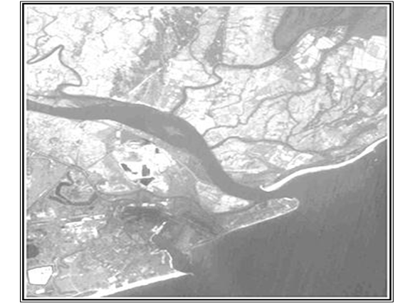
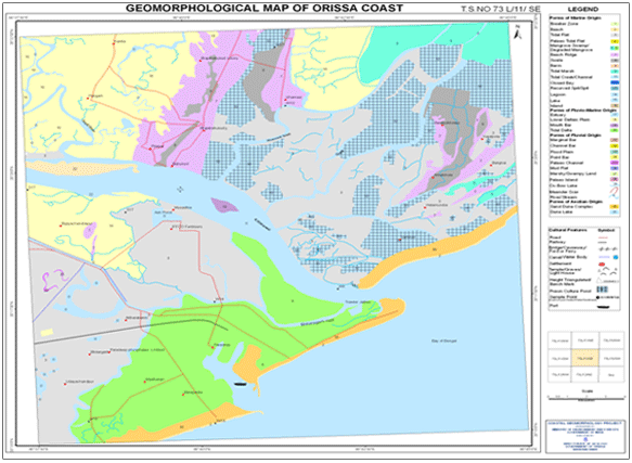
 The cell has taken up a project based on Remote Sensing studies for analysis of coastal geomorphic features along Odisha coast under the sponsorship of Ministry of Environment and Forest (MoEF), Govt. of India. Under the above project a rich database, relating to coastal tract of Odisha starting from Odisha-Andhra Pradesh border in south to Dhamra in north, has been generated in GIS environment for various end users. The cell has taken up a project based on Remote Sensing studies for analysis of coastal geomorphic features along Odisha coast under the sponsorship of Ministry of Environment and Forest (MoEF), Govt. of India. Under the above project a rich database, relating to coastal tract of Odisha starting from Odisha-Andhra Pradesh border in south to Dhamra in north, has been generated in GIS environment for various end users.
|